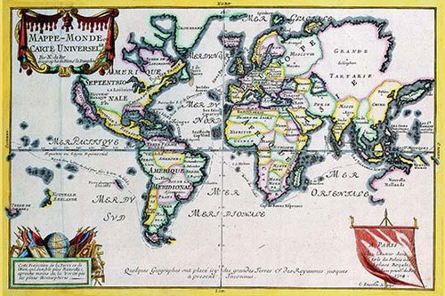
Product Overview
George Louis Le Rouge (1740 1780) gradually took up cartography during and after a career as a military engineer. He produced many attractive plans of fortifications, military campaigns, town plans and several atlases and sea charts. George-Louis le Rouge (c. 1712- 80) was a Paris based map publisher operating in the middle part of the 18th century. Le Rouge was born in Hanover Germany as Georg Ludwig, where he was educated and employed as a military engineer and surveyor. Around 1740 Le Rouge moved to Paris, Francophied his name, and set up shop on the Rue Des Grands Augustins as an engraver, book publisher and map publisher. Despite being born German and adopting Paris as his home, Le Rouge was an ardent Anglophile and spent much of his time translating English books and maps into French. Much of his cartographic work was based upon English maps. During his active period of roughly forty years Le Rouge produced thousands of maps and diagrams ranging from city and town plans, to atlases, plans of military campaigns and sea charts. He was awarded by his diligence with the title Geógraphe du Roi. Le Rouge also worked with Benjamin Franklin to produce the important 1769 Franklin/Folger Map of the Gulf Stream. Franklin, who met Le Rouge in Paris, writes that Le Rouge is, I believe, a proper person. - There is a border around the image. Image size is correct. Many sizes available.


